Discover California's Geography, History, and Culture with California Maps
From the towering Sierra Nevada to the vibrant streets of Los Angeles, this collection of maps provides a detailed exploration of California's landscapes, historical landmarks, and cultural diversity.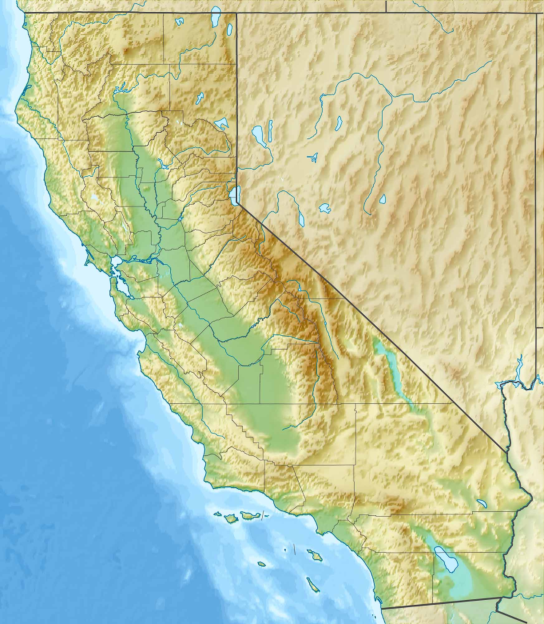
A Comprehensive Guide to California Maps
Please subscribe on "World Guide" channnel on Youtube at youtube.com/c/WorldGuide
1. California Physical Map
The physical map of California is a vibrant display of its natural features. It highlights the state's varied topography, including the Sierra Nevada mountains, the Central Valley, and the Pacific Coast. This map is a testament to California's diverse natural landscapes, from its majestic mountains to its serene beaches.
2. California Political Map
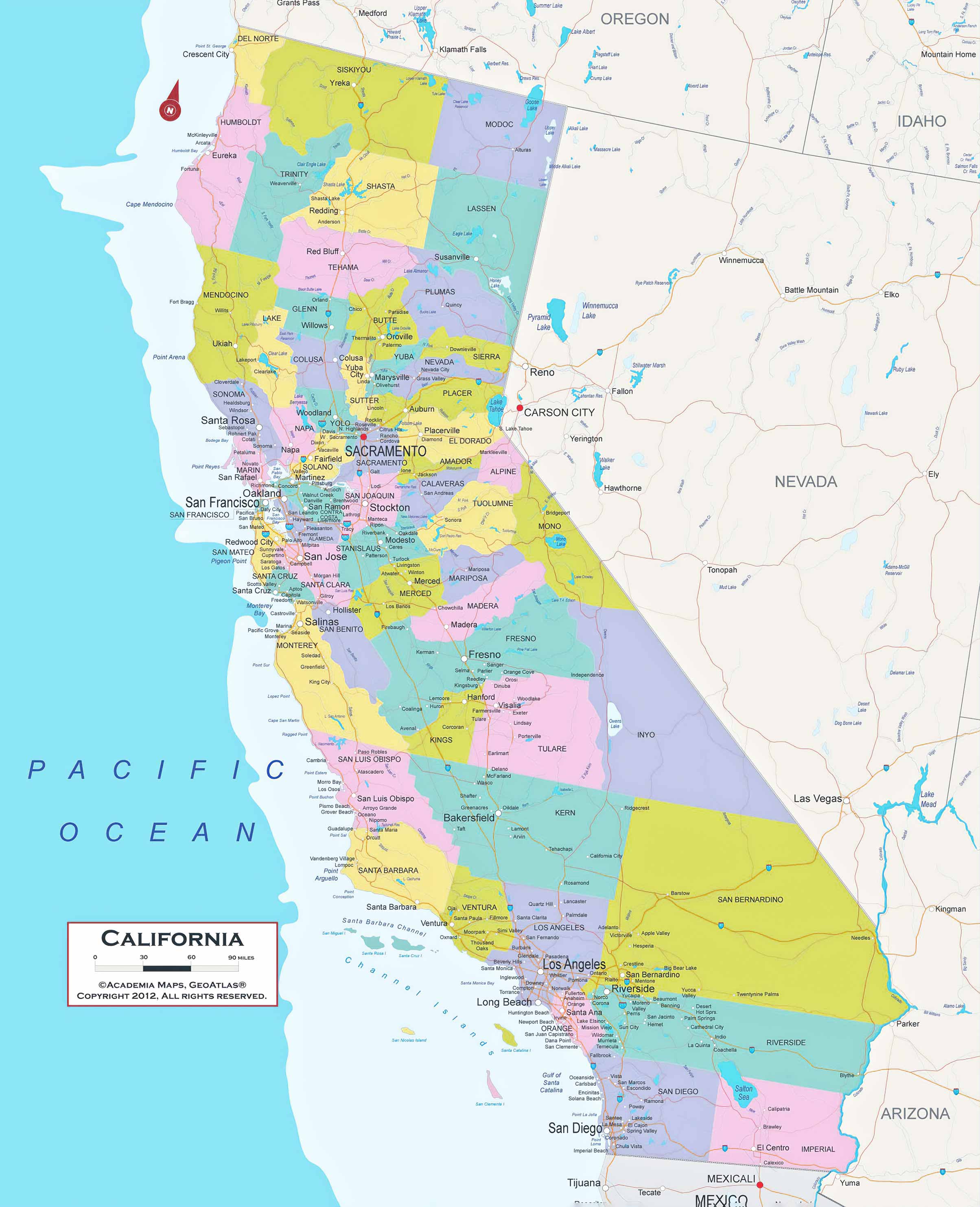
California's political map is a colorful illustration of its governmental boundaries. It delineates the state's counties and major cities, showcasing the political divisions that shape its governance. This map is crucial for understanding California's political landscape and its influence on national politics.
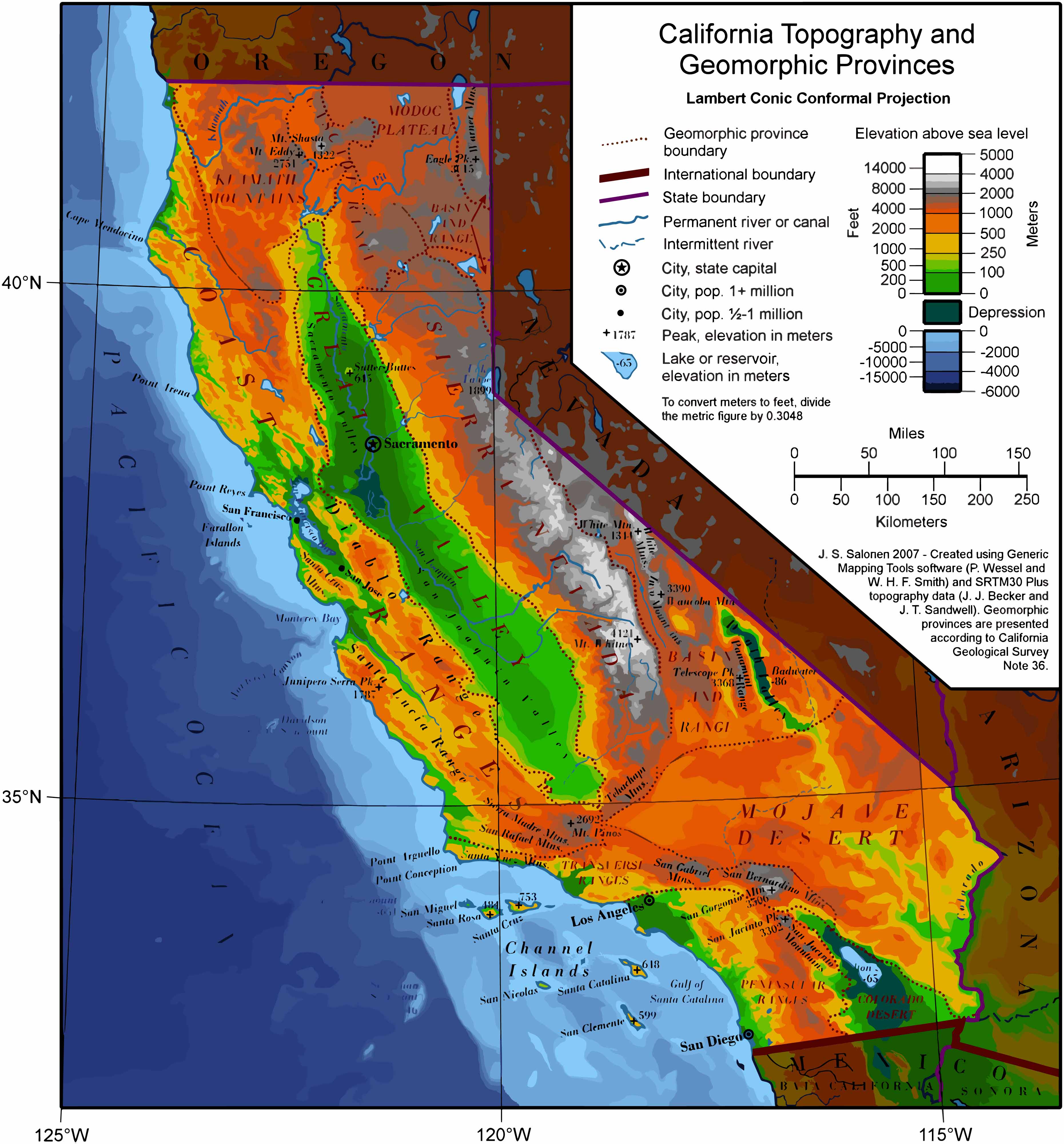
3. California Topographic Map
The topographic map of California is a detailed representation of the state's terrain. It shows elevation changes, illustrating the heights of mountains and depths of valleys. This map is particularly useful for hikers, geologists, and those interested in the physical contours of the land.
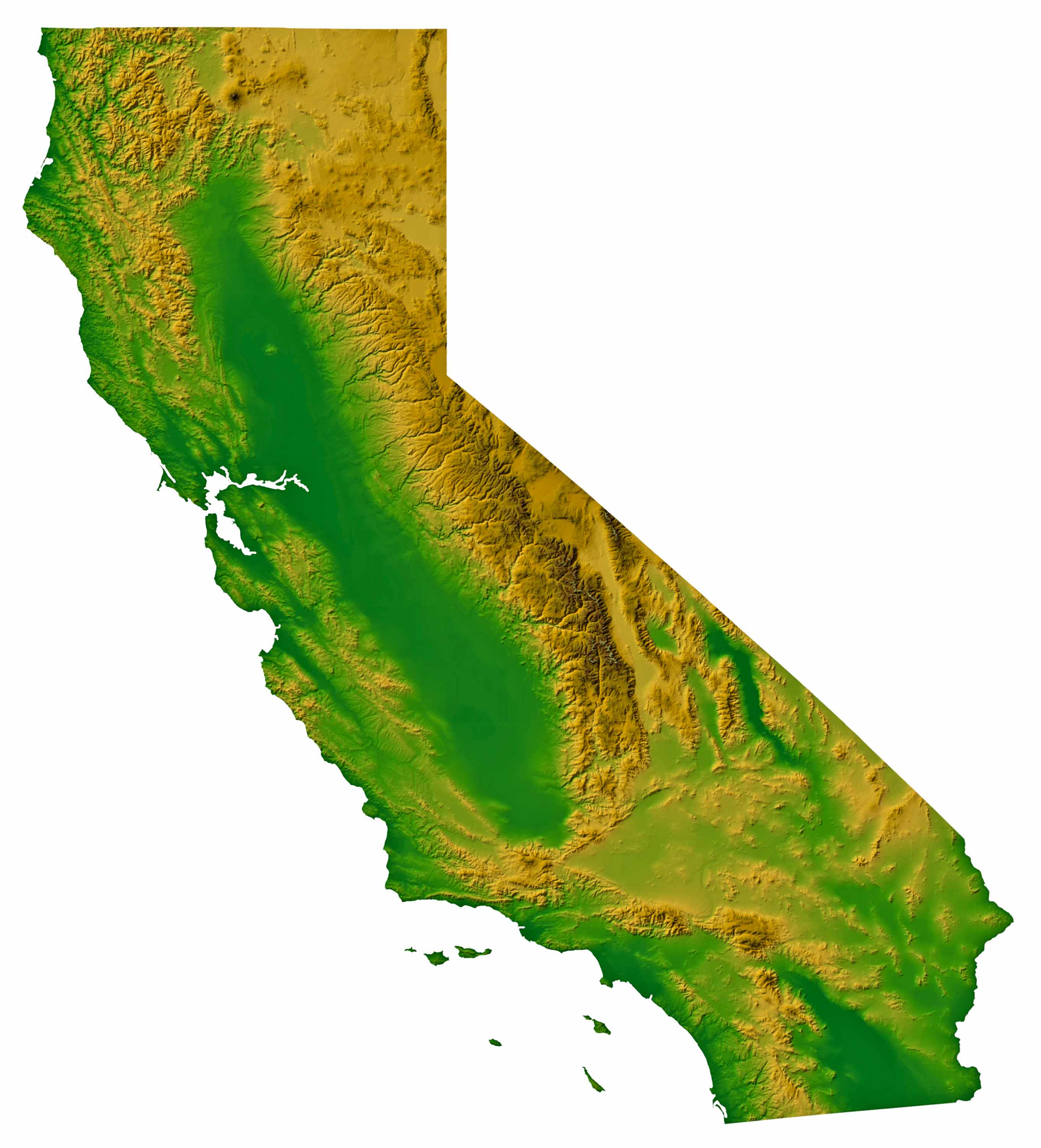
4. California Relief Map
A relief map brings California's terrain to life with 3D visualization. It accentuates mountains, valleys, and plains, providing a tactile sense of the state's topography. This map is perfect for visual learners and anyone fascinated by the physical shape of the landscape.
5. California Geological Map
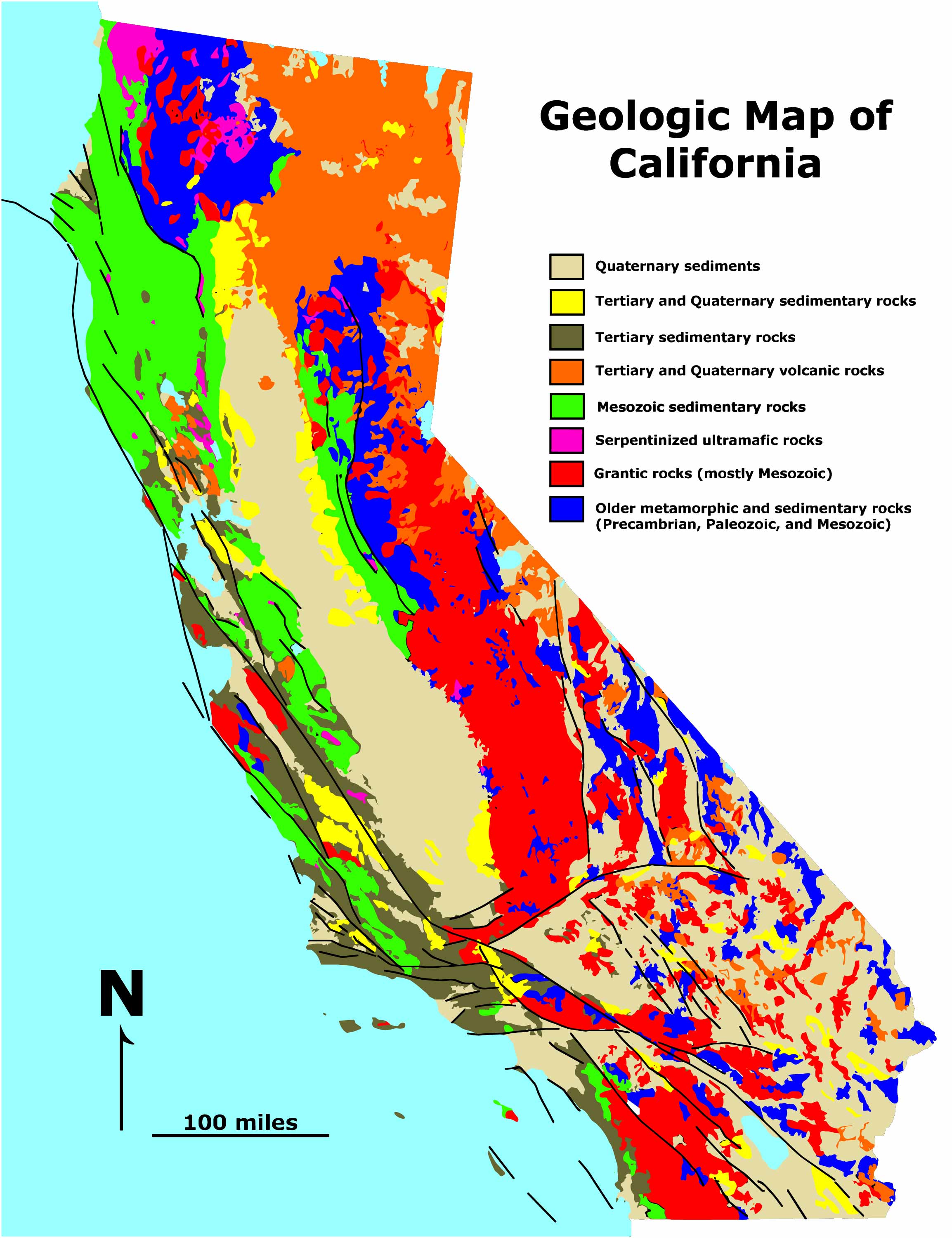
California's geological map is a window into its earthly composition. It reveals the various rock formations and fault lines, including the famous San Andreas Fault. This map is essential for understanding California's seismic activity and geological history.
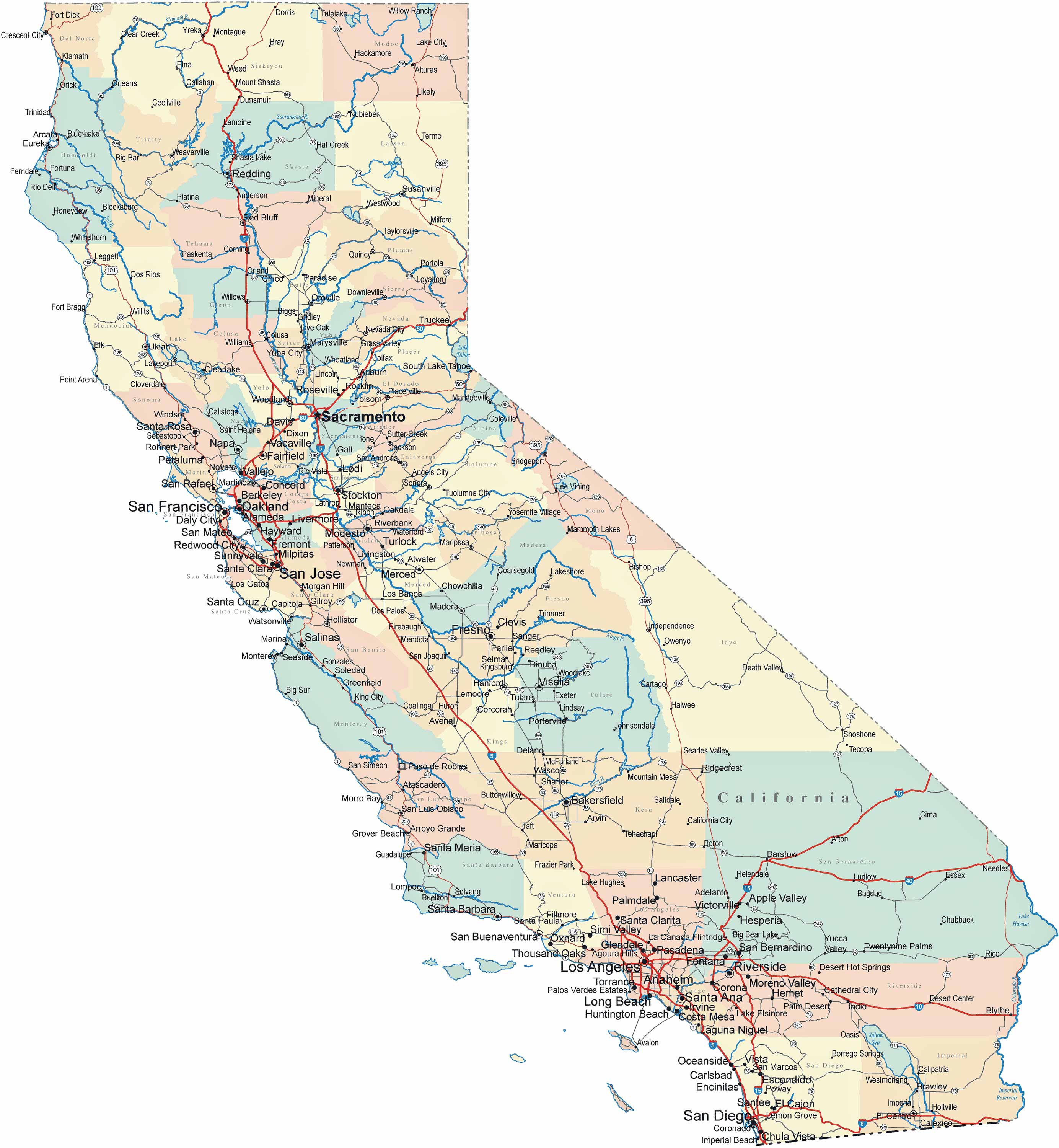
6. California Cities, Counties, Capitals Map
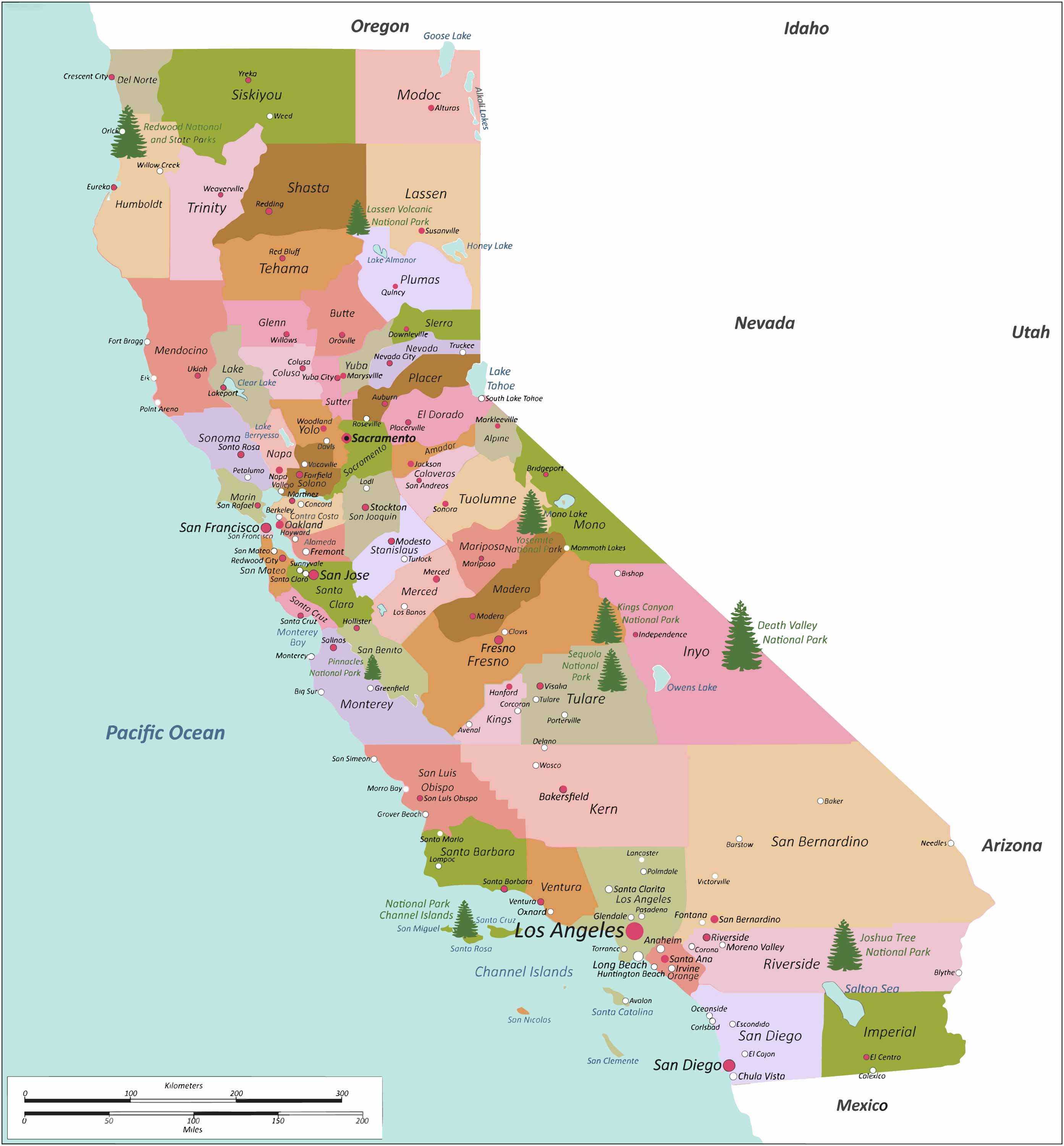
The urban map of California highlights its bustling cities and urban landscapes. From the sprawling metropolis of Los Angeles to the tech hub of Silicon Valley, this map showcases the state's urban diversity and development.
7. California Historical Map (1856)
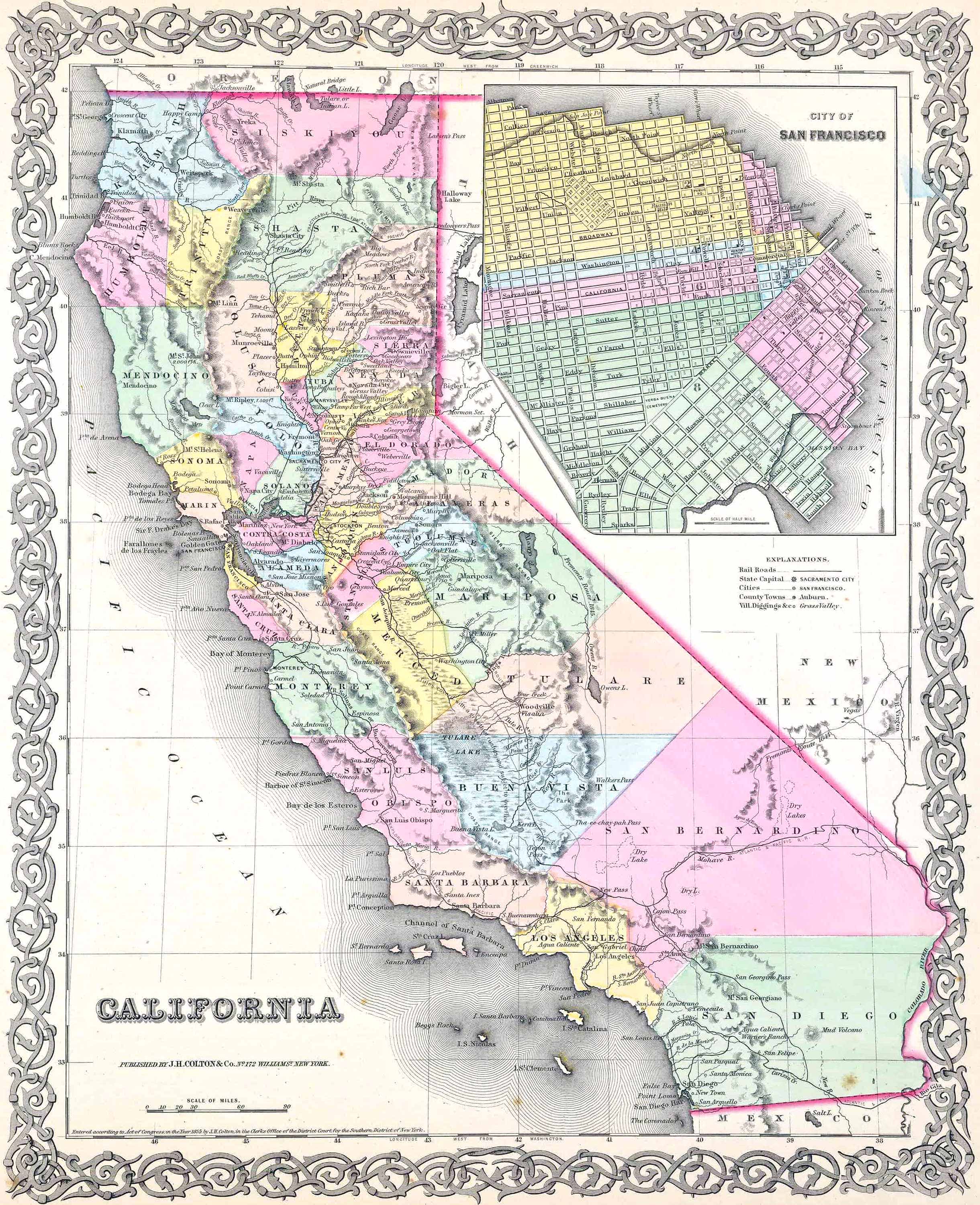
A journey through California's past, the historical map traces the state's evolution over time. It highlights significant historical events, settlements, and changes in territorial boundaries, offering a glimpse into California's rich history.
8. California Regions Map
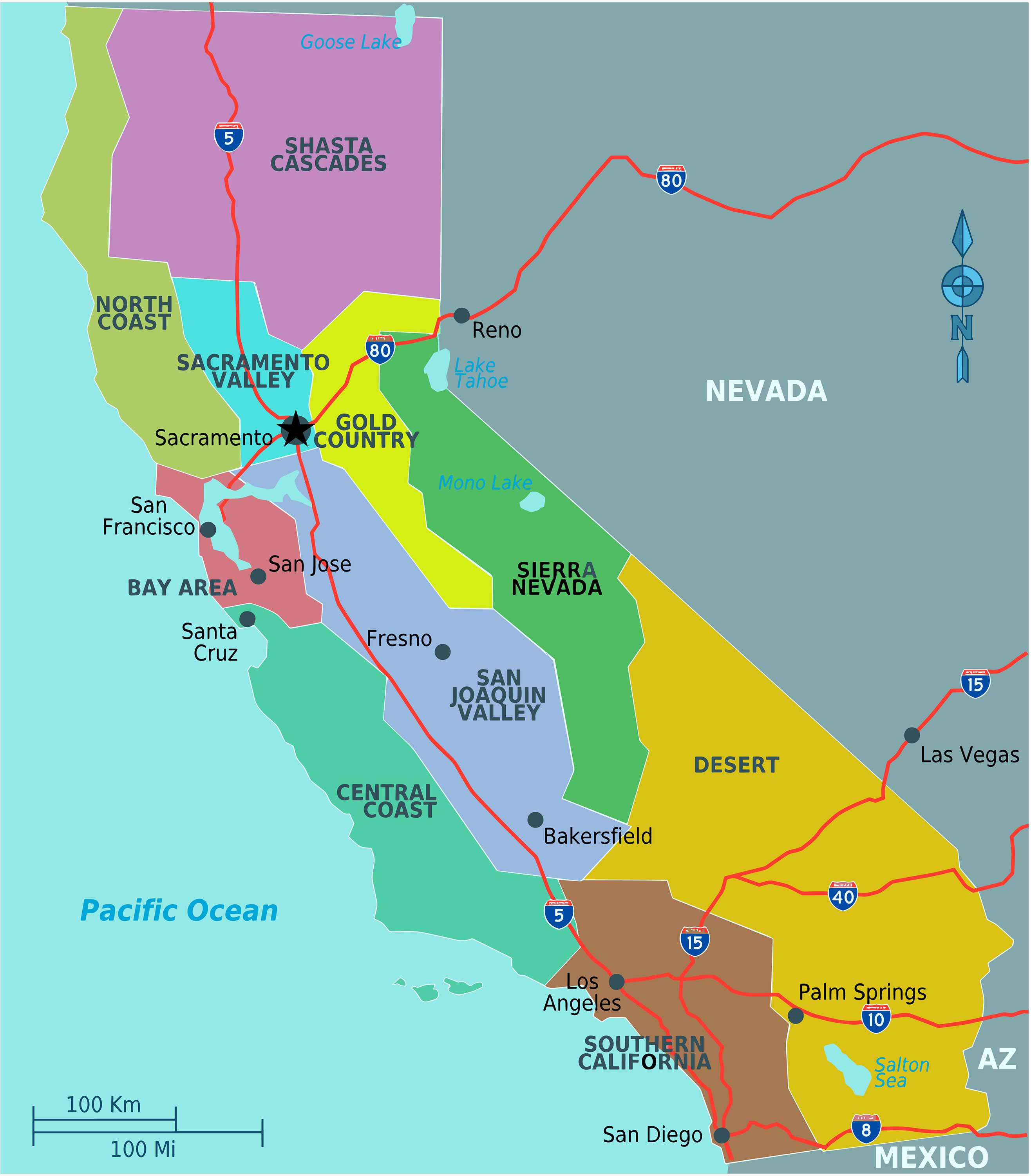
The regions map of California divides the state into its distinct areas, each with its own unique characteristics. From the wine country of Napa Valley to the deserts of Southern California, this map showcases the state's regional diversity.
9. California Transit Map
California's transit map is a guide to its public transportation systems. It includes major transit routes, including buses and trains, essential for navigating the state's cities and towns.
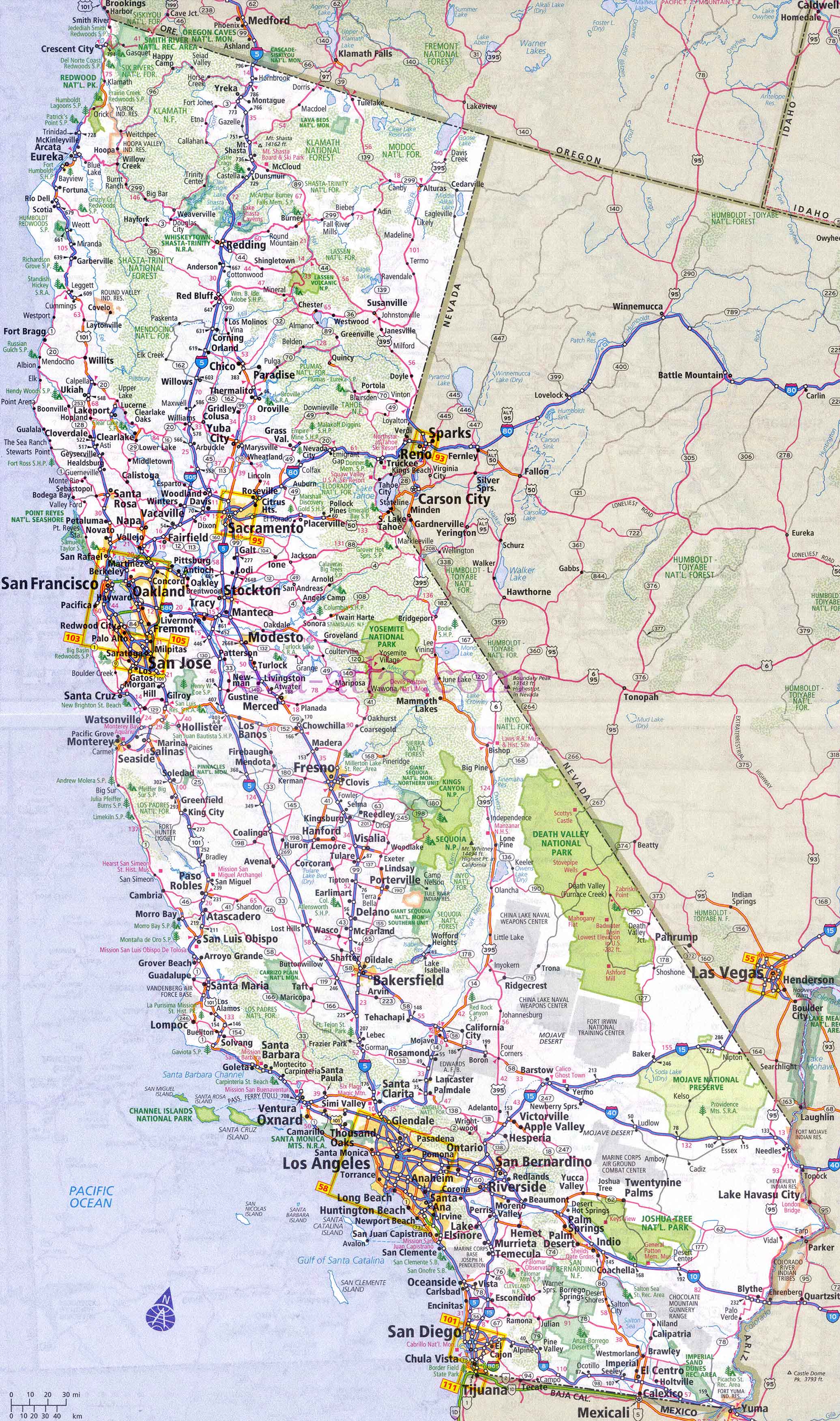
10. California Road Map
The road map of California is an indispensable guide for travelers and commuters. It outlines highways, state roads, and local routes, providing a comprehensive view of the state's road network.
11. California Train-Railway Map

This map highlights California's railway system, showcasing major train routes and stations. It's a valuable resource for those traveling by rail, whether for daily commutes or scenic journeys.
12. California Climatic Map
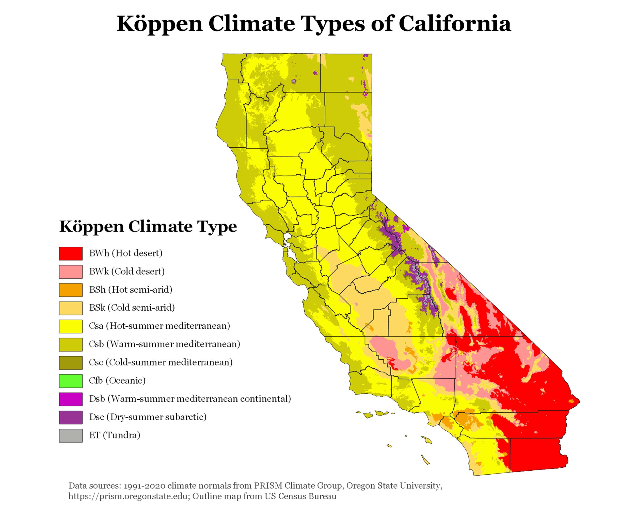
The climatic map of California illustrates its varied climate zones. From the Mediterranean climate of the coast to the arid conditions of the desert, this map helps in understanding the state's diverse weather patterns.
13. California Blank Map
A blank map of California offers a canvas for educational purposes or creative projects. It allows for custom annotations, making it a versatile tool for learners and enthusiasts alike.
14. California Flag Map
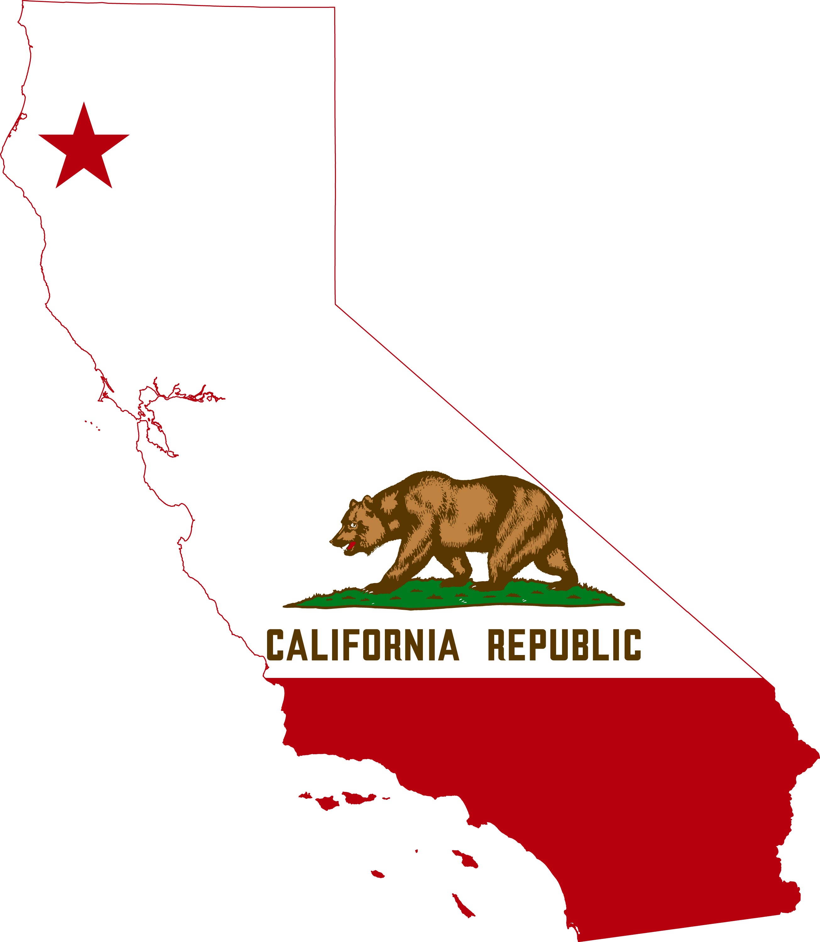
The flag map merges California's iconic bear flag with its geographic outline. It's a symbolic representation of state pride and identity, resonating with both residents and admirers of California.
15. California Travel-Tourist Map
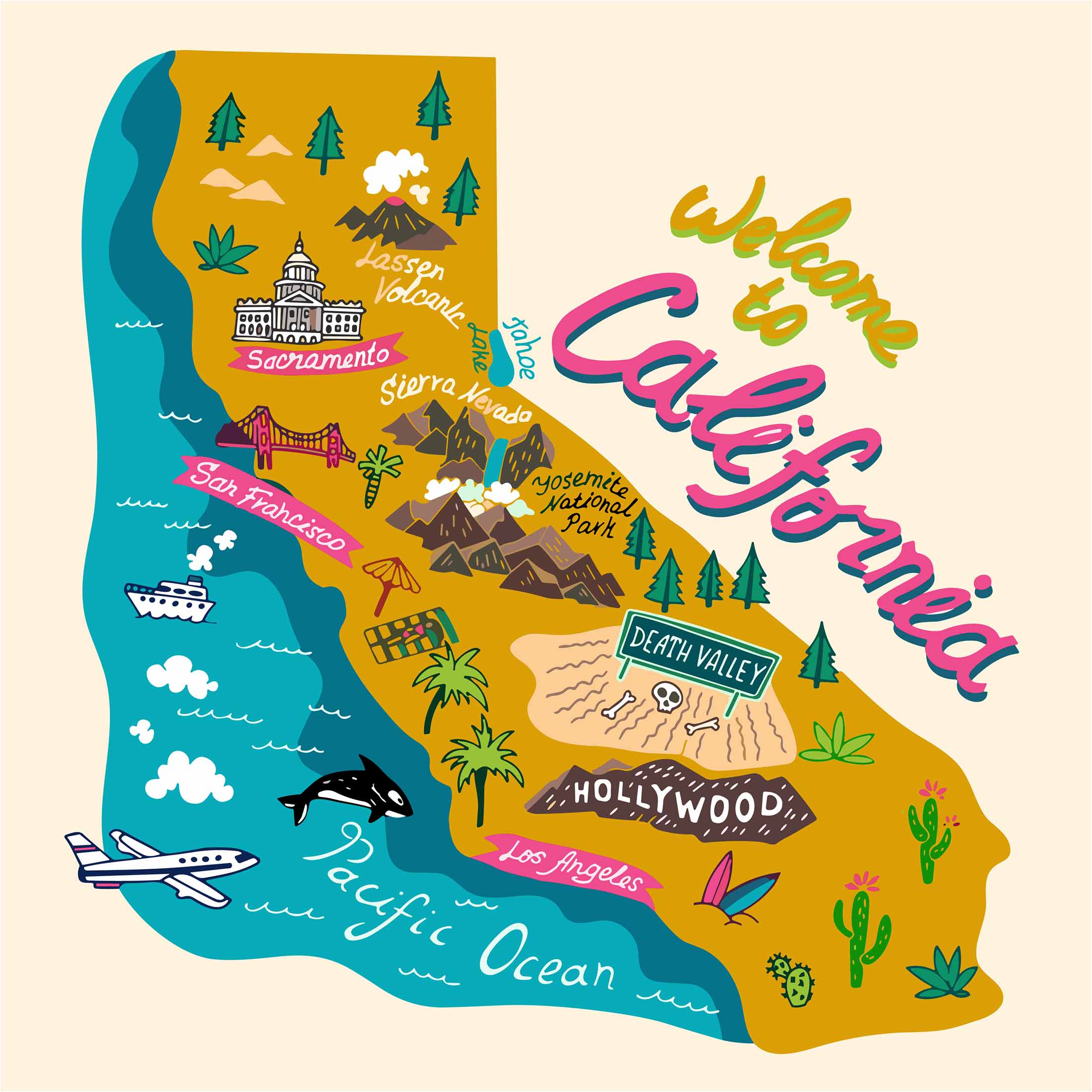
This map is tailored for travelers, highlighting California's top tourist attractions, scenic routes, and leisure spots. It's the perfect companion for anyone planning a California adventure.
16. Map of California's Location in the US Map
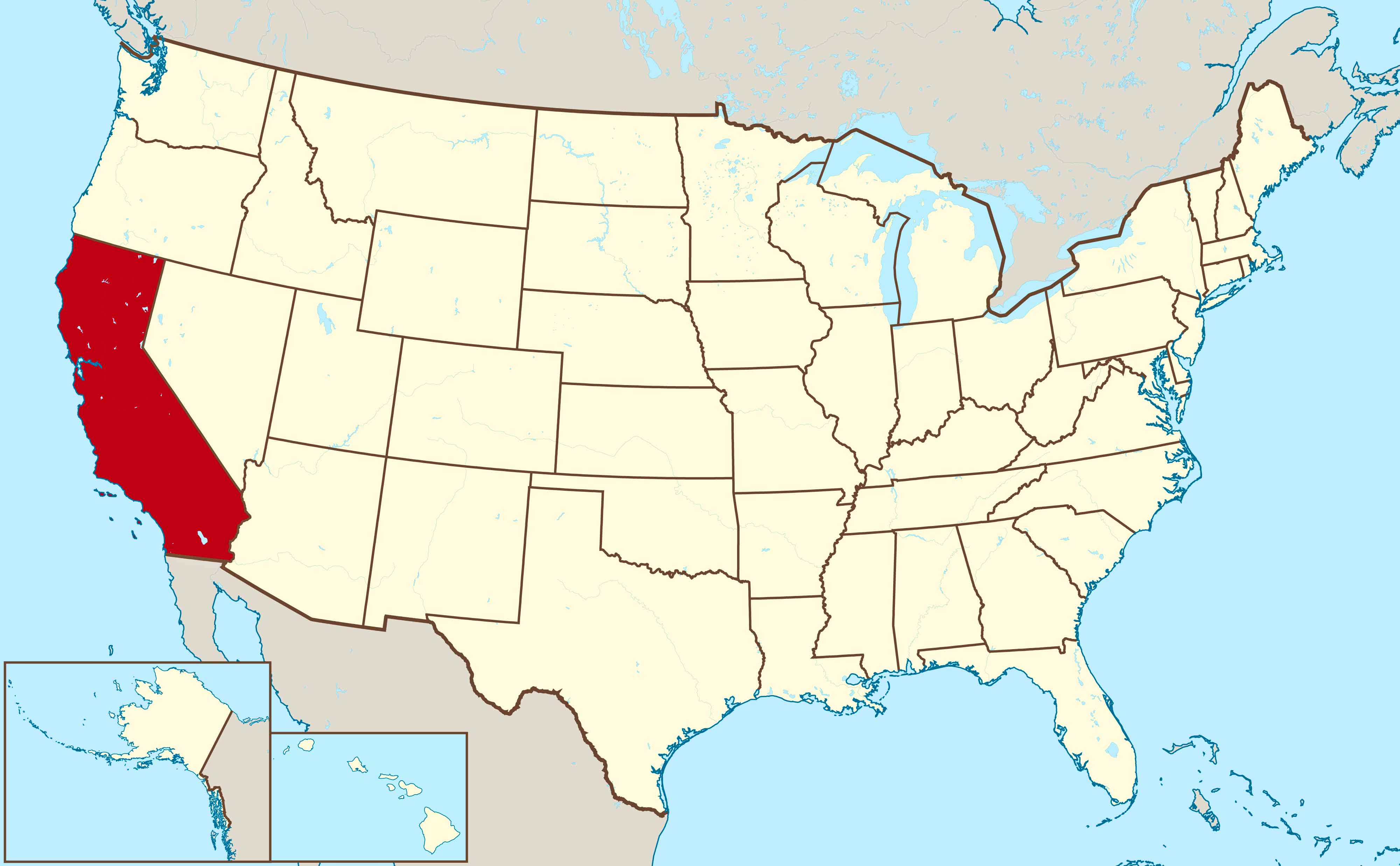
This global perspective places California within the world map, illustrating its position on the United States. It provides a context for its global significance and geographical location.
17. California Earth Satellite Map
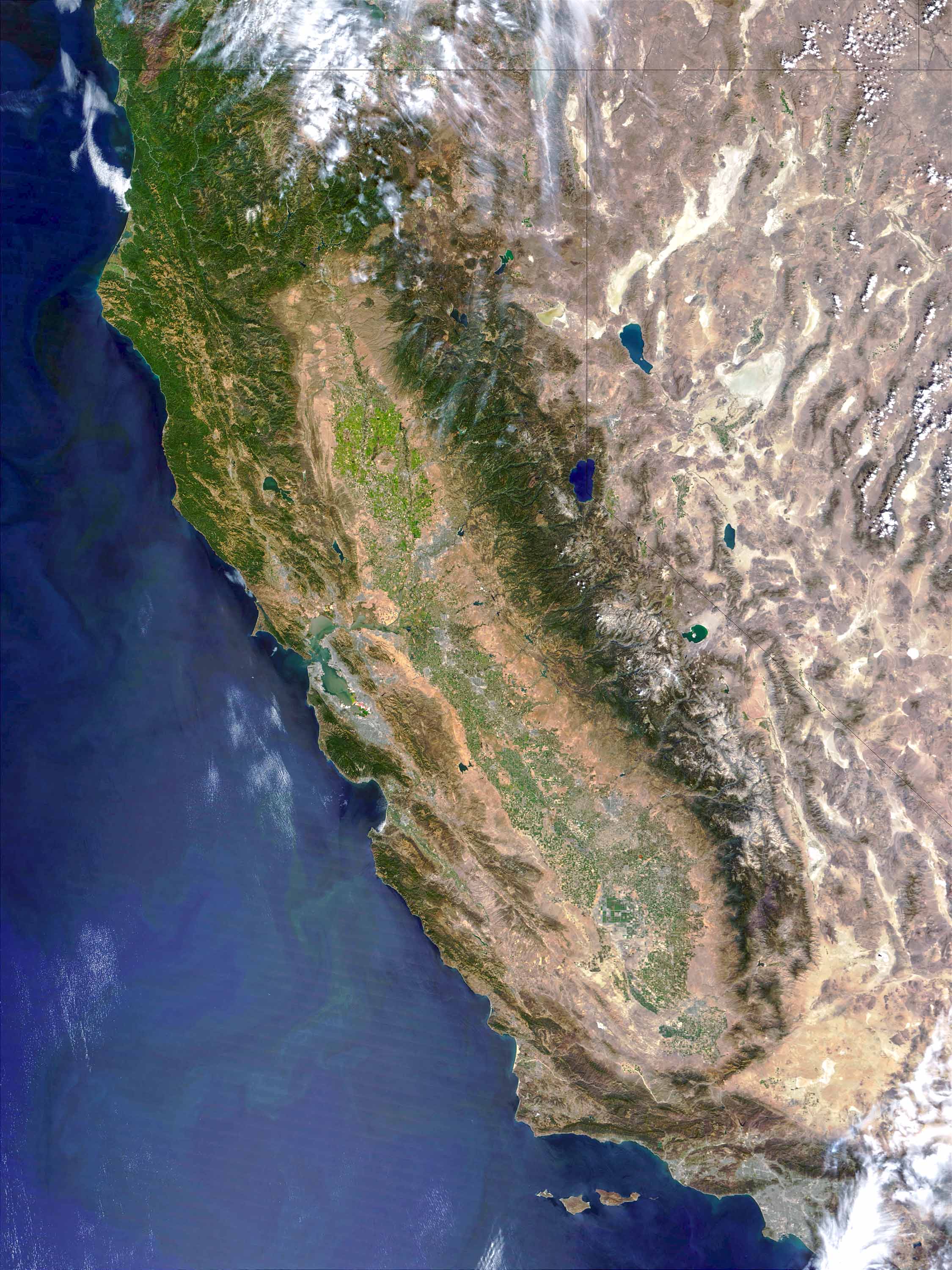
An Earth satellite map offers a stunning view of California from space. It showcases the state's natural color palette and geographical features as seen from orbit, providing a unique perspective.
For more California Maps and About California;
Copyright Turkey Travel Guide - 2005 - 2025. All rights reserved. Privacy Policy | Disclaimer