Iowa Map
Navigate Iowa Map, Iowa states map, satellite images of the Iowa, Iowa largest cities maps, political map of Iowa, driving directions and traffic maps.For all Iowa Cities Map
Iowa Map & Iowa Satellite Images
map of iowa
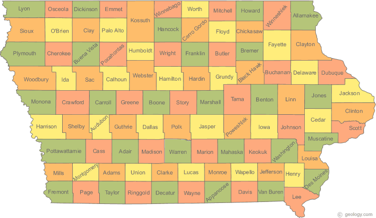
Iowa Map & Iowa Satellite Images
Iowa highways map
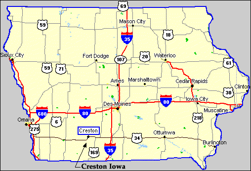
Iowa Maps
- Map of Iowa
- Iowa Cities Map
- Iowa County Map
- Iowa Highways Map
- Iowa Physical Map
- Iowa River Map
- Iowa Road Map
- Iowa Route Map
- Iowa State Map
- State Map of Iowa
A Collection of Iowa Maps and Iowa Satellite Images
MAP OF IOWA

IOWA CITIES MAP
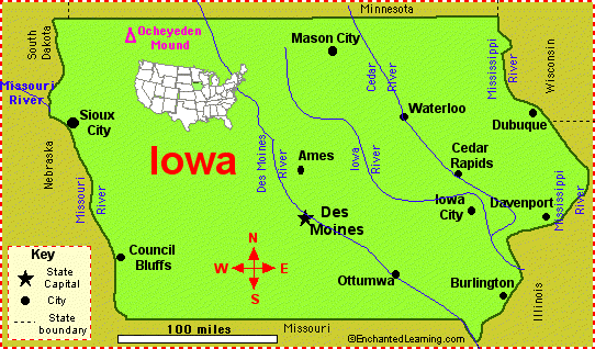
IOWA COUNTY MAP
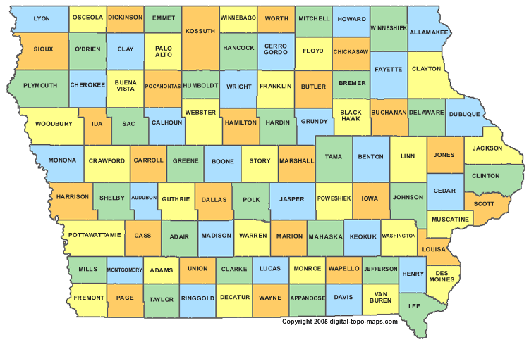
IOWA HIGHWAYS MAP

IOWA PHYSICAL MAP
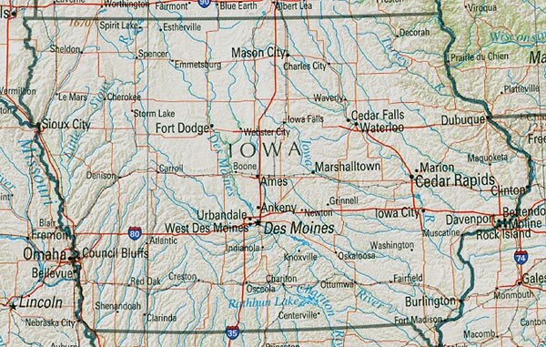
IOWA RIVER MAP
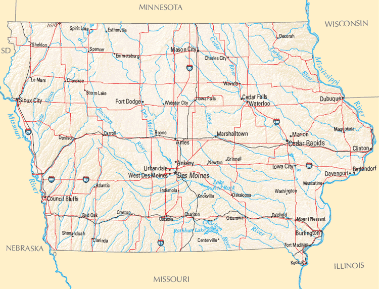
IOWA ROAD MAP
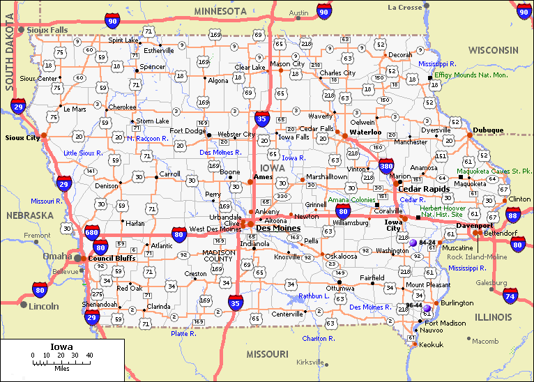
IOWA ROUTE MAP
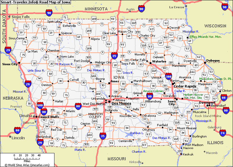
IOWA STATE MAP
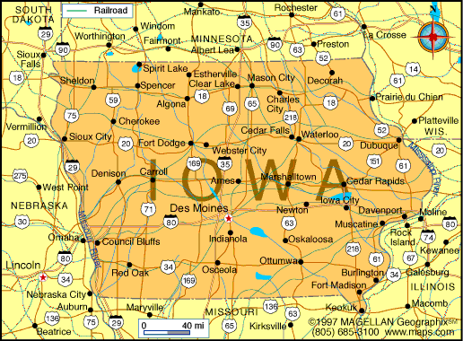
STATE MAP OF IOWA
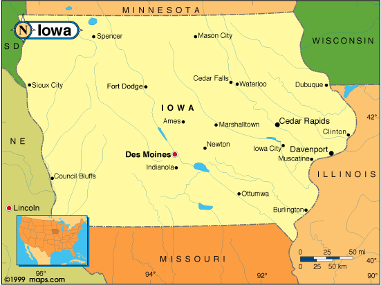
A collection of Iowa Maps
Largest Cities Map of Iowa and Population
- Des Moines Map - 203,433 - (41.601 / -93.609)
- Cedar Rapids Map - 126,326 - (42.008 / -91.644)
- Davenport Map - 99,685 - (41.524 / -90.578)
- Sioux City Map - 82,684 - (42.5 / -96.4)
- Waterloo Map - 68,406 - (42.493 / -92.343)
- Iowa City Map - 67,862 - (41.661 / -91.53)
- Council Bluffs Map - 62,230 - (41.262 / -95.861)
- Ames Map - 58,965 - (42.035 / -93.62)
- Dubuque Map - 57,637 - (42.501 / -90.665)
- West Des Moines Map - 56,609 - (41.572 / -93.745)
- Ankeny Map - 45,582 - (41.731788, -93.600128)
- Urbandale Map - 39,463 - (41.626655, -93.712166)
- Cedar Falls Map - 39,260 - (42.534899, -92.445316)
- Marion Map - 34,768 - (42.034400, -91.589549)
- Bettendorf Map - 33,217 - (41.564233, -90.476182)
United States Largest Cities Map by Population
New York City Map Los Angeles Map Chicago Map Brooklyn Map Houston Map Philadelphia Map Manhattan Map Phoenix Map San Antonio Map San Diego Map Dallas Map San Jose Map Jacksonville Map Indianapolis Map San Francisco Map Austin Map Columbus Map Fort Worth Map Charlotte Map Detroit Map El Paso Map Memphis Map Baltimore Map Boston Map Seattle Map Nashville Map Denver Map Louisville Map Milwaukee Map Portland Map Las Vegas Map Oklahoma City Map Albuquerque Map Tucson Map Fresno Map Sacramento Map Long Beach Map Kansas City Map Mesa Map Virginia Beach Map Atlanta Map Colorado Springs Map Omaha Map Raleigh Map Miami Map Cleveland Map Tulsa Map Oakland Map Honolulu Map Minneapolis MapCopyright Turkey Travel Guide - 2005 - 2025. All rights reserved. Privacy Policy | Disclaimer


