Turkey Map
world map
» turkey map
Turkey Map
Navigate Turkey map, satellite images of the Turkey, states, largest cities, political map, capitals and physical maps.
Click for Content Detail »
A Collection of Turkey Maps
Turkey Satellite Map
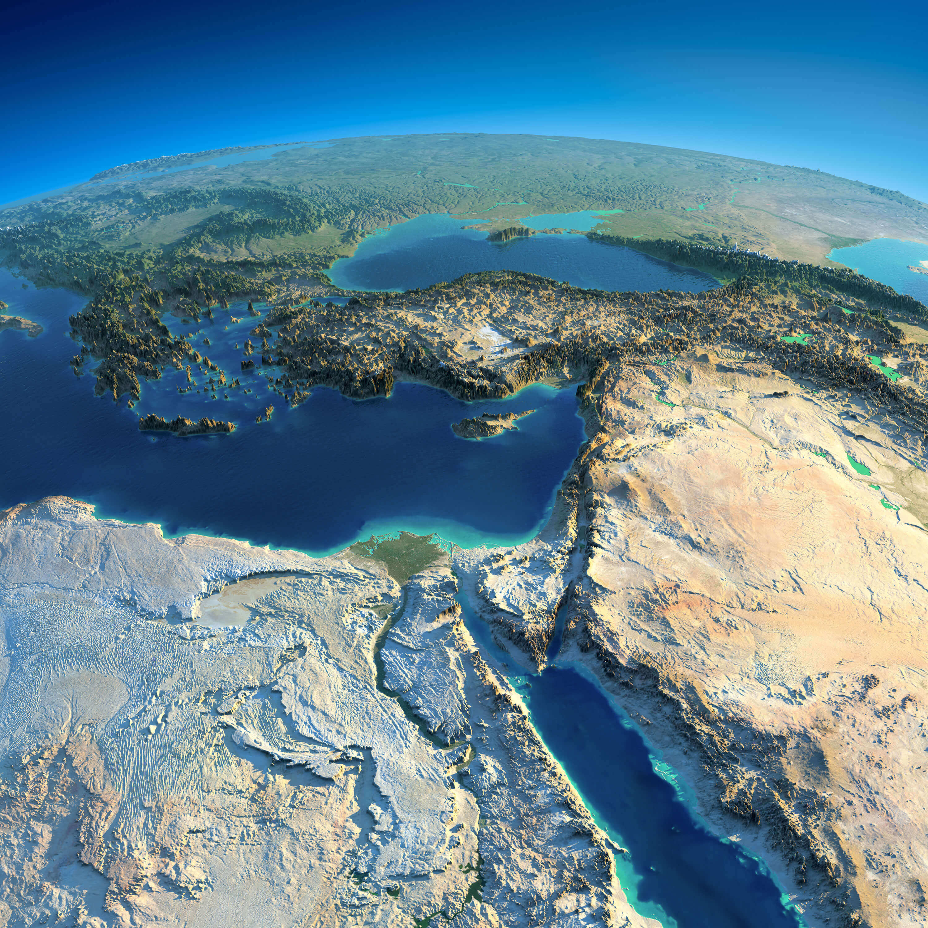
Highly detailed planet Earth and Turkey, Africa and Middle East in the morning. Exaggerated precise relief lit morning sun.
Turkey Administrative Map
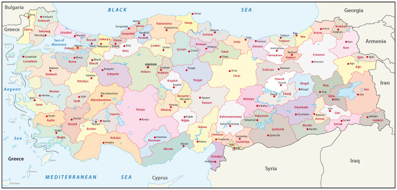
Turkey administrative map with ciites' borders.
Turkey and Middle East Countries Satellite Image
Turkey and Middle East countries and night planet Earth with precise detailed relief and city lights illuminated by moonlight.
Photograph of map Syria Jordan and Turkey
Close-up macro photograph of map Syria Jordan and Turkey. Selective focus on Syria.
Turkey Map with Flag Buttons
Turkey Map with Flag Buttons and Assistance & Activates Icons Original Illustration.
Turkey Color Map
Vector map of Turkey country
Turkey Road Map
Turkey Road Map with National Borders.
Turkey Main Cities Map
Detailed map of Turkey, Detailed color Turkey map with main cities.
Turkey Regions & Provinces Map
A large, colorful and detailed map of Turkey with all regions, provinces and big cities.
Detailed Map of Turkey with Major Cities
Highly detailed map of Turkey, vector with Major Cities.
Turkey Satellite Map
Turkey 2-digit postcodes map and provinces borders.
Turkey Railroad Map
Turkey Railroad Map with cities.
Turkey Political Map
Turkey Political Map with capital Ankara, national borders, most important cities, rivers and lakes. English labeling and scaling. Illustration.
Click for Google Map »
Where baslik on World Map
Click for Direction »
baslik Road Map and Direction